
Land, corridor and aerial coverage
Flexible platforms for terrestrial, corridor, coastal and difficult-access environments.
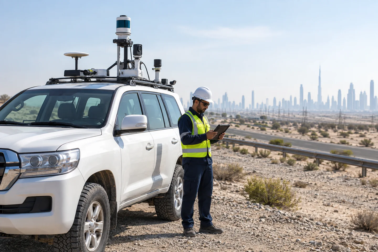
Car-Based Environmental Survey
A vehicle-mounted survey platform efficiently captures continuous, georeferenced observations along roads, project corridors, industrial areas and large accessible sites. It supports repeatable baseline, construction and operational surveys without repeatedly establishing static stations.
Suitable for
Survey configuration: GNSS/INS positioning with LiDAR or panoramic imagery, supplemented where required by air-quality, noise, meteorological or thermal sensors. Survey speed, traffic safety, sensor height and calibration are defined in the method statement.
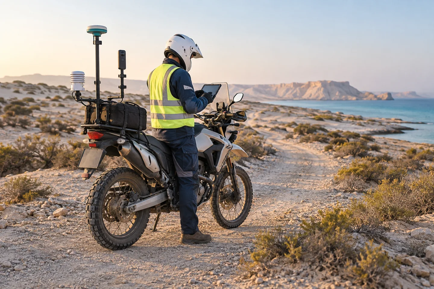
Motorbike Environmental Survey
A compact motorbike platform extends mobile environmental surveying to narrow tracks, congested areas and routes where a car would be slow, intrusive or unable to enter. It is suited to rapid reconnaissance and linear coverage with a smaller operating footprint.
Suitable for
Survey configuration: Compact GNSS, 360-degree imagery and selected environmental sensors are mounted securely within safe weight and visibility limits. Route risk, rider competence, terrain, weather and data quality are assessed before deployment.
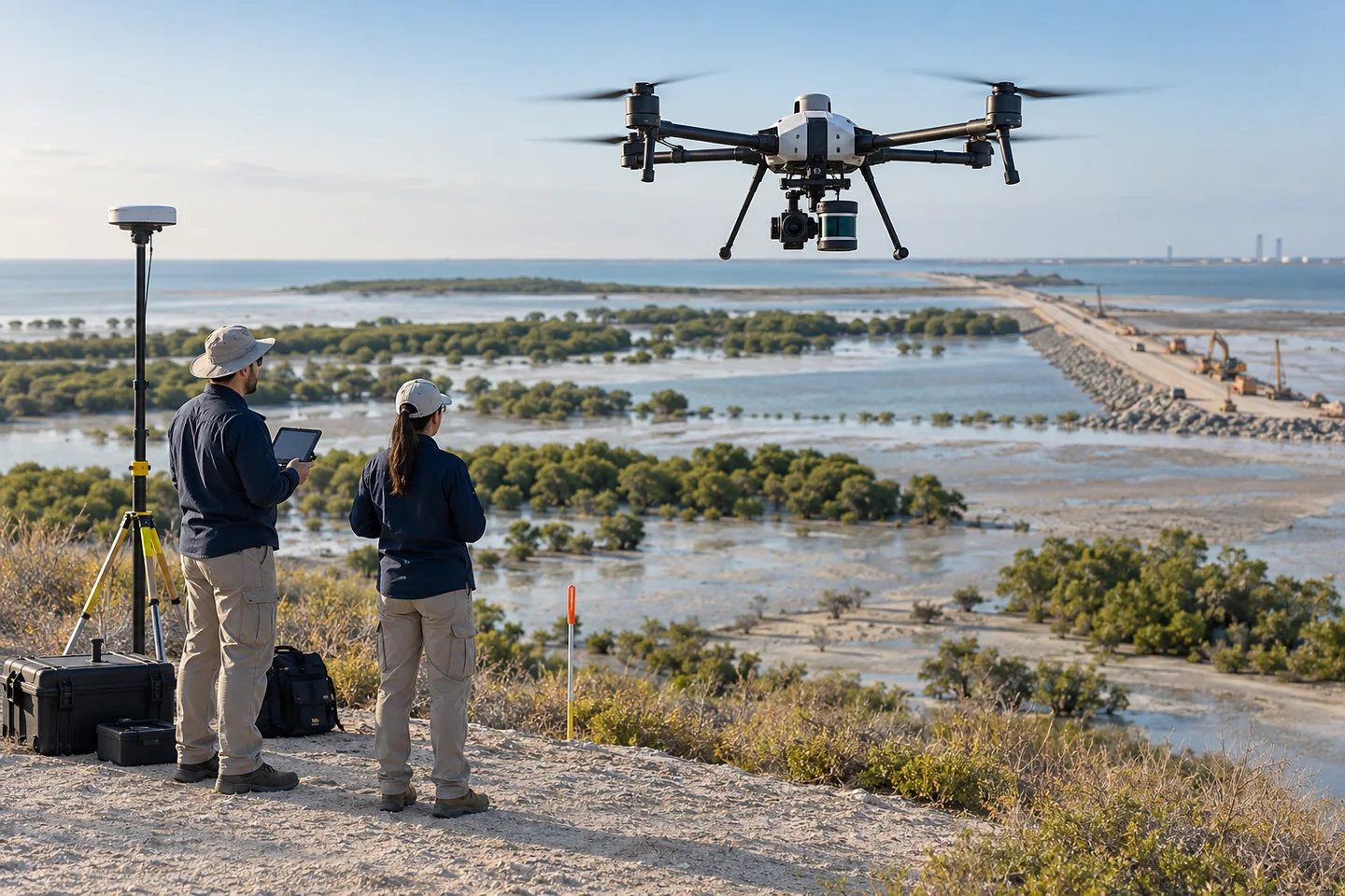
Drone Environmental Survey
Drone surveys provide high-resolution aerial evidence across habitats, shorelines, construction zones and inaccessible ground. Repeat flights can quantify land-cover, erosion, drainage and terrain change while reducing exposure in difficult areas.
Suitable for
Survey configuration: Survey-grade imagery, RTK/PPK positioning and—where appropriate—multispectral, thermal or LiDAR payloads. Flight permissions, airspace, ground control, weather, line of sight, wildlife sensitivity and resolution are planned for each mission.
Surface, subsea and vessel-based coverage
Marine platforms selected for water depth, coverage, seabed access, endurance and required sampling or sensing.
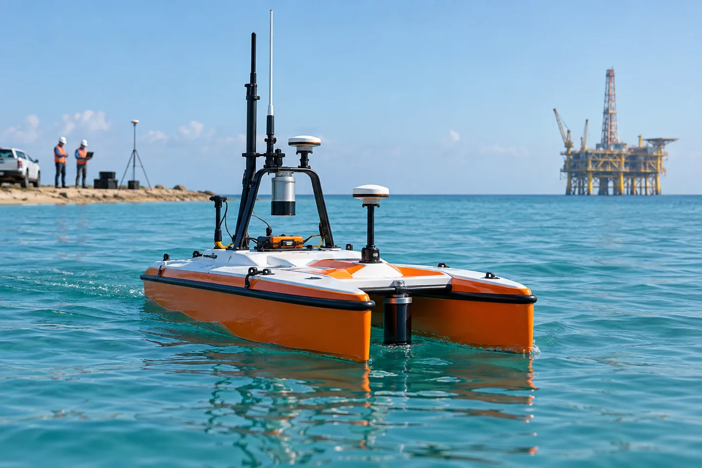
USV Environmental Survey
An uncrewed surface vessel provides repeatable, remotely supervised coverage in shallow, confined or operationally sensitive waters. Its low draft and endurance can reduce personnel exposure while supporting dense survey lines and continuous environmental measurements.
Suitable for
Survey configuration: GNSS, telemetry and collision-aware mission control with payloads such as multibeam or single-beam sonar, ADCP and water-quality sondes. Navigation permissions, communications, sea state, recovery planning and local vessel traffic are assessed.
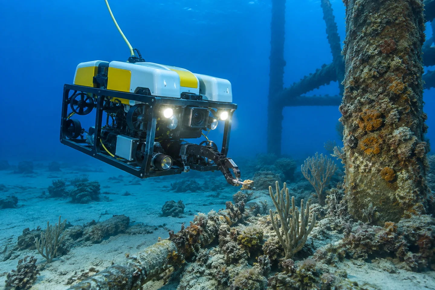
ROV Environmental Survey
A tethered remotely operated vehicle brings cameras, lights and sensors to submerged habitats, structures and seabed features that cannot be adequately assessed from the surface. Live video allows the survey team to adapt the inspection and document findings precisely.
Suitable for
Survey configuration: HD video, scaling lasers, imaging sonar, depth and environmental sensors with optional sampling tools. Water depth, visibility, current, tether management, launch and recovery, positioning and support-vessel requirements determine the ROV class.
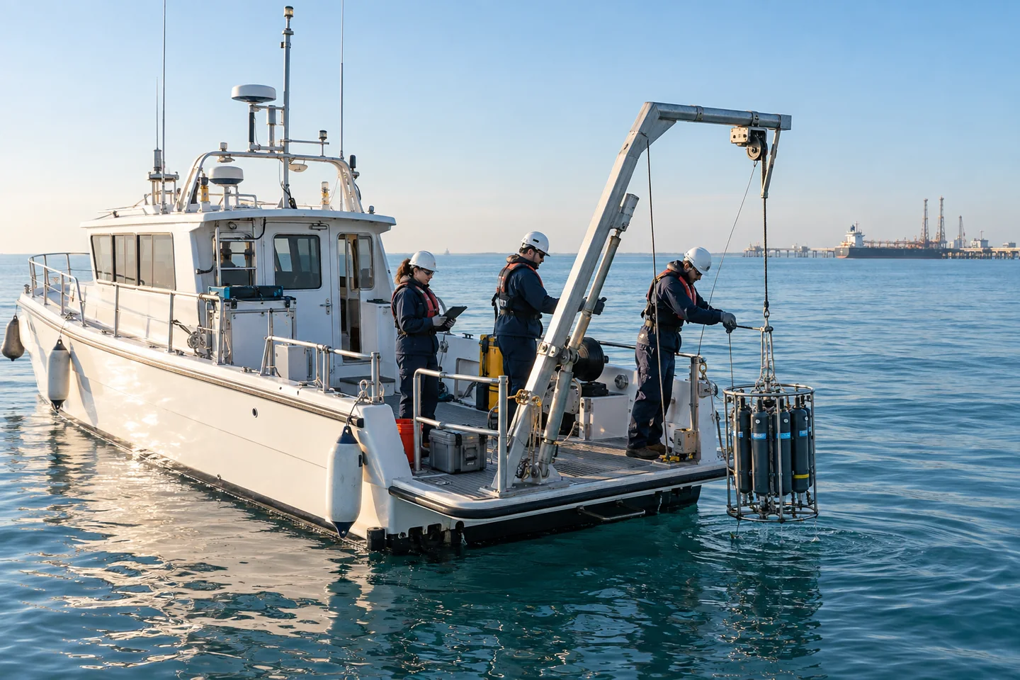
Boat-Based Environmental Survey
A crewed survey boat carries specialists and multiple instruments for coordinated offshore sampling, profiling and mapping. It is the most flexible option for programmes requiring larger payloads, physical samples, longer endurance or direct expert control at sea.
Suitable for
Survey configuration: The vessel may support CTD and water samplers, grabs or corers, sonar, current profilers, laboratories and positioning systems. Vessel suitability, crew competence, deck layout, lifting arrangements, weather limits and sample custody are planned together.
Planning and delivery support
- Survey objective, platform and sensor selection
- Onshore route, flight or offshore line planning
- Permissions, access, marine coordination and method statements
- GNSS control, calibration and time synchronisation
- Field quality checks, repeat observations and sample custody
- Georeferenced datasets, imagery, maps and technical reporting
Discuss Environmental Survey with SIAGIS
Share the location, intended use, target date and available background information.